Free Course Image Physical Geography

Free online coursePhysical Geography

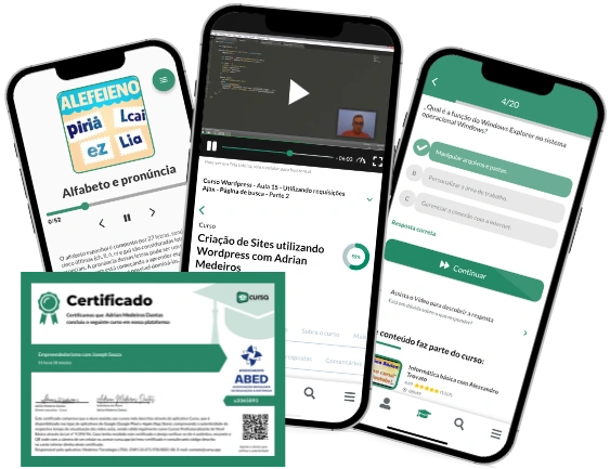
Duration of the online course: 11 hours and 24 minutes

5

StarStarStarStarStar

(1)

Build real-world mapping, weather, rocks and landform skills in this free online Physical Geography course—practice with quizzes and earn a certificate-ready foundation.

In this free course, learn about

  • Physical geography focus: Earth systems, processes, and patterns shaping the natural environment
  • Using latitude/longitude to locate places; latitude’s mapping significance and time zones from longitude
  • Public Land Survey System purpose and township/range land division basics
  • Topographic maps: contour rules, V-shaped valleys, and drawing contours from elevation data
  • Astronomy basics: Big Bang overview and distinguishing observation vs interpretation
  • Geologic time concepts: fossils/dinosaurs context and the law of superposition
  • Seasons explained by Earth’s axial tilt; solar budget, albedo, shortwave vs longwave radiation
  • Atmospheric circulation: Hadley Cell, lapse rates (DALR/SALR), humidity/pressure, major gases
  • Cloud identification and severe-weather clouds (e.g., cumulonimbus) and storm formation basics
  • Minerals: definition requirements and identification using key physical properties (esp. hardness)
  • Rock cycle: igneous/sedimentary/metamorphic processes and how heat/pressure drive metamorphism
  • Weathering vs erosion; soil horizons (O, B) and soil texture triangle/field texture ID
  • Plate tectonics drivers; faults, earthquakes, volcanism controls; San Andreas/Farallon examples
  • Geomorphology by agent: coastal tides/waves, rivers transport, wind dunes/saltation, glaciers U-valleys/cirques

Course Description

Physical geography helps you make sense of how Earth works as a connected system, from the coordinates that place you on a map to the atmospheric patterns that shape climate, and from the rocks beneath your feet to the landforms carved by wind, rivers, waves, and ice. This free online course is designed for learners who want a clear, practical foundation in geography as a school subject, while also building skills that transfer to earth science, environmental studies, planning, and everyday decision-making.

You will strengthen core map-reading confidence by learning how latitude and longitude locate any place on the planet and how time relates to longitude. You will also get comfortable interpreting topographic maps and contour patterns so you can visualize terrain rather than just see lines on a page. As the course moves into the atmosphere, you connect seasons to Earth’s geometry, explore how energy flows through the solar budget and albedo, and understand circulation patterns that drive weather. Concepts like lapse rate and cloud formation become useful tools for explaining what you observe outdoors, not just definitions to memorize.

The course also grounds you in essential geology: mineral identification, the rock cycle, and the forces that rebuild Earth’s crust through plate tectonics, faulting, earthquakes, and volcanism. You then apply that knowledge to landscape change through weathering, erosion, and soils, including horizons and texture—key ideas for interpreting ecosystems and land use. Finally, you travel across major geomorphic environments, examining coastal processes and tides, river systems, deserts and wind transport, and the signatures of glaciation. Throughout, short checks for understanding reinforce the science and help you learn actively, making it easier to retain concepts and explain Earth processes with accuracy.

By the end, you will be able to link location, time, climate, materials, and landforms into one coherent picture—an ideal preparation for school success, further study, or anyone who wants to read the landscape with new clarity.

Course content

  • Video class: Introduction to Your Course | Physical Geography with Prof. Jeremy Patrich 2021 11m
  • Exercise: What is a key focus of physical geography as described in the introduction to the course?
  • Video class: Introduction to Physical Geography | OER Units 1-4 Overview 08m
  • Exercise: What is the significance of latitude in geographical mapping?
  • Video class: Introduction to Physical Geography | Physical Geography with Professor Patrich 26m
  • Exercise: What are the two primary branches of geography discussed in a typical geography course?
  • Video class: Latitude and Longitude: Mapping the Earth | Physical Geography with Professor Patrich 29m
  • Exercise: Which system is primarily used to specify every location on Earth by a set of numbers?
  • Video class: Longitude and Time | How-To Geography Videos With Jeremy Patrich 10m
  • Exercise: If Location X is at a longitude of 30 degrees west and Location Y is at 90 degrees west, what is the time difference between these two locations?
  • Video class: Township 10m
  • Exercise: What was the primary purpose of the Public Land Survey System introduced by the Land Ordinance Act of 1785?
  • Video class: Read 09m
  • Exercise: What does a V-shaped contour line on a topographic map typically indicate?
  • Video class: Drawing Contour 06m
  • Exercise: What is a critical rule about how contour lines behave on a topographic map?
  • Video class: Drawing Contour Lines on a Map | How-To Geography Videos With Jeremy Patrich 03m
  • Exercise: When creating a contour map, what is primarily used to determine the placement of contour lines?
  • Video class: From Big Bang to Big Questions: Unraveling the Universe with Modern Astronomy | Earth Science 15m
  • Exercise: Which of the following best describes the difference between observation and interpretation in astronomy?
  • Video class: Dinosaurs 24m
  • Exercise: What is the law of superposition, as it relates to geology?
  • Video class: Introduction to Weather and Climate | OER Units 5-7 Overview 05m
  • Exercise: Which factor is primarily responsible for the change of seasons on Earth?
  • Video class: Reasons for Earths Seasons | Physical Geography with Professor Patrich 25m
  • Exercise: What is the primary reason for the different seasons experienced on Earth?
  • Video class: The Solar Budget, Albedo 28m
  • Exercise: What is the primary difference between shortwave and longwave radiation in the context of solar energy reaching Earth?
  • Video class: Weather 101: Introducing Atmospheric Circulation 20m
  • Exercise: Which of the following is a correct description of the Hadley Cell?
  • Video class: Calculating Lapse Rate | How-To Geography Videos With Jeremy Patrich 09m
  • Exercise: When ascending a mountain, at what point do you switch from using the Dry Adiabatic Lapse Rate (DALR) to the Saturated Adiabatic Lapse Rate (SALR) to calculate the change in temperature?
  • Video class: Introduction to Clouds | Physical Geography with Professor Patrich 17m
  • Exercise: Which of the following cloud types is characterized by its ability to produce severe weather phenomena such as thunderstorms and even tornadoes?
  • Video class: Introduction to Geology: Minerals 04m
  • Exercise: Which of the following processes involves the transformation of a sedimentary rock into another type of rock through heat and pressure?
  • Video class: Introduction to Minerals and Identification | Physical Geography with Professor Patrich 23m
  • Exercise: Which of the following is not a requirement for a substance to be classified as a mineral?
  • Video class: The Rock Cycle: Igneous, Sedimentary, 25m
  • Exercise: Which of the following statements is true about metamorphic rocks?
  • Video class: Farallon Plate, San Andreas Fault 03m
  • Exercise: What type of geological feature is the Farallon Plate associated with in the region of Mecca, California?
  • Video class: Physical and Chemical Weathering | OER Units 12 Overview 03m
  • Exercise: Which soil horizon is composed mainly of organic material such as decomposed leaves and plant matter?
  • Video class: Secrets in Sediment: Unearthing Earth's Past with Weathering, Erosion 17m
  • Exercise: What is the primary difference between weathering and erosion as described in the context of shaping landscapes?
  • Video class: Soil Texture Triangle - Comparison of Particle Size | How-To Geography Videos With Jeremy Patrich 06m
  • Exercise: When identifying soil texture in the field, what is the characteristic of sand based on its texture?
  • Video class: Soil Horizons 09m
  • Exercise: What is the primary function of the B horizon (subsoil) in a soil profile?
  • Video class: Earth's Dynamic Crust and Lithosphere | OER Units 13-15 Overview 05m
  • Exercise: Which of the following statements is true regarding plate tectonics and the movement of Earth's plates?
  • Video class: Earth's Dynamic Lithosphere 28m
  • Exercise: What is a key driver of the tectonic plate movement on Earth?
  • Video class: San Andreas Fault Pressure Ridge California Geology Palmdale | Out in the Field with Jeremy Patrich 03m
  • Exercise: What geological feature is formed as a result of two tectonic plates meeting and creating a fold in the Earth's crust?
  • Video class: Introduction to Earthquakes 30m
  • Exercise: Which type of fault involves the vertical displacement of rock layers, causing one side to be thrust upward relative to the other?
  • Video class: Beyond Lava: Volcanoes, Pyroclastic Material 19m
  • Exercise: What is one of the three primary factors that determine the characteristics of volcanic eruptions?
  • Video class: ? Decoding Earth's Sculpture: A Geomorphological Journey Through Wind, Water 29m
  • Exercise: What is Aeolian geomorphology the study of?
  • Video class: Coastal Beach Geomorphology | OER Unit 16 Overview 05m
  • Exercise: What are the primary forces responsible for generating tides?
  • Video class: Coastal 101: Exploring Landforms, Tides 25m
  • Exercise: What mainly causes waves in the ocean?
  • Video class: Fluvial Geomorphology | OER Unit 17 Overview 07m
  • Exercise: In fluvial environments, how is material primarily moved along a river system?
  • Video class: Fluvial (Rivers) Geomorphology | Physical Geography with Professor Patrich 35m
  • Exercise: What is the primary purpose of studying fluvial geomorphology?
  • Video class: Arid Desert Environments Aeolian Geomorphology | OER Unit 18 Overview 06m
  • Exercise: In aeolian geomorphology, what is the primary mode of wind transportation where grains are lifted and then impact the surface, dislodging other material?
  • Video class: Aeolian (Arid 32m
  • Exercise: Which of the following best explains how wind influences the formation of sand dunes in arid environments?
  • Video class: Glacial Environments and Geomorphology | OER Unit 19 Overview 08m
  • Exercise: What feature is created by glaciers that results in a very steep, large U-shaped valley?
  • Video class: Bishop, California, Lake Sabrina 03m
  • Exercise: What is the term used to describe the amphitheater-shaped feature formed by glaciers advancing and digging into the ground?
  • Video class: Glacial Geomorphology | Physical Geography with Professor Patrich 35m
  • Exercise: Which of the following best describes the process by which glaciers carve out deep valleys in a U-shaped formation?
  • Video class: Mastering the Science of the Atmosphere: Decoding Humidity, Pressure 43m
  • Exercise: Which of the following gases makes up the largest percentage of Earth's atmosphere?
  • Video class: How to Identify Minerals: The Physical Properties | How-To Geography With Jeremy Patrich 07m
  • Exercise: What is considered the most reliable physical property for identifying minerals?

This free course includes:

11 hours and 24 minutes of online video course

Digital certificate of course completion (Free)

Exercises to train your knowledge

100% free, from content to certificate

Ready to get started?Download the app and get started today.

Install the app now

to access the course
Icon representing technology and business courses

Over 5,000 free courses

Programming, English, Digital Marketing and much more! Learn whatever you want, for free.

Calendar icon with target representing study planning

Study plan with AI

Our app's Artificial Intelligence can create a study schedule for the course you choose.

Professional icon representing career and business

From zero to professional success

Improve your resume with our free Certificate and then use our Artificial Intelligence to find your dream job.

You can also use the QR Code or the links below.

QR Code - Download Cursa - Online Courses

Course comments: Physical Geography

KA

Kagisho Andries Mothobi

StarStarStarStarStar

I did enjoy the course, and it really makes a huge difference in my life. Thank you so much for bringing such a momentous course.

More free courses at Geography

Free Ebook + Audiobooks! Learn by listening or reading!

Download the App now to have access to + 5000 free courses, exercises, certificates and lots of content without paying anything!

  • 100% free online courses from start to finish

    Thousands of online courses in video, ebooks and audiobooks.

  • More than 60 thousand free exercises

    To test your knowledge during online courses

  • Valid free Digital Certificate with QR Code

    Generated directly from your cell phone's photo gallery and sent to your email

Cursa app on the ebook screen, the video course screen and the course exercises screen, plus the course completion certificate