Free Course Image Geography

Free online courseGeography

Duration of the online course: 28 hours and 42 minutes

4.62

StarStarStarStarHalf star

(21)

Build exam-ready geography skills with a free online course—master maps, climate, oceans, and Indian geography through clear videos and quick practice.

In this free course, learn about

  • Using lat/long to locate places; time zones, International Date Line, and time calculation
  • Earth interior, S & P waves, rock cycle, geological time scale, and crust element abundance
  • Evidence and mechanism of continental drift and sea-floor spreading; mid-ocean ridge landforms
  • Plate tectonics basics: oceanic vs continental plates and boundary processes shaping the crust
  • Formation of fold mountains and major examples: Andes, Rockies, Himalayas; African Rift Valley
  • Major landforms worldwide: mountains, plateaus (and their resources), plains, rivers and drainage
  • Volcanism, earthquakes, tsunamis: causes, distribution, impacts, and key risk concepts
  • Oceanography: resources, EEZ, currents, waves, upwelling, tides, ports; temp & salinity budgets
  • Coral reef formation, distribution, threats; marine pollution types and management ideas
  • Atmospheric structure, heat budget, inversions; humidity measures; winds, rainfall types, aurora
  • Jet streams, air masses and fronts; cyclones, thunderstorms, tornadoes; ENSO and polar vortex
  • Climatic regions and types: deserts, grasslands, monsoon, Mediterranean, tundra, taiga, China type
  • Indian physiography: Himalayas, plains, plateaus; rivers, drainage, monsoon, climate & forests
  • India soils, land use, agriculture, irrigation, reforms; floods/droughts, water resources, erosion

Course Description

Strengthen your understanding of the world with a focused, free online geography course that turns big topics into clear, usable knowledge. Whether you are revising school concepts or aiming for competitive exam readiness, this course helps you connect physical processes to real places, so you can read maps better, interpret patterns faster, and explain causes and effects with confidence.

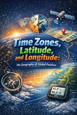
You will begin with the essential language of location: latitude, longitude, time zones, and the International Date Line. From there, the course builds a solid foundation in how Earth works beneath the surface, linking the planet’s interior, seismic waves, the rock cycle, and geological time to the landscapes we see. With key ideas like continental drift, sea-floor spreading, and plate tectonics, you will learn to reason about why mountains rise, oceans widen, and rift valleys form, instead of memorizing isolated facts.

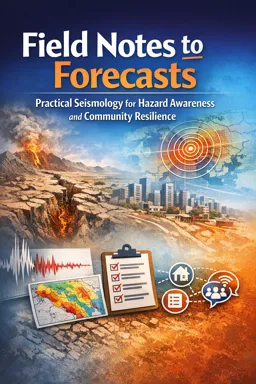
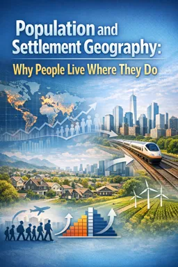
The learning then broadens into landforms across the globe—mountains, plateaus, plains, and rivers—showing how each shapes settlement, resources, and development. Geophysical hazards are explained in a way that makes volcanic activity, earthquakes, and tsunamis easier to visualize and write about, especially when you need crisp explanations for exams or assignments.

A dedicated set of lessons on oceans and atmosphere connects environmental systems to everyday outcomes. You will work through ocean resources and maritime zones, coral reefs and pollution, currents, waves, tides, temperature and salinity patterns, and then move into climatology: atmospheric structure, heat budget, rainfall and winds, jet streams, fronts, cyclones, and phenomena such as El Niño and La Niña. Climatic regions are covered with a clear sense of what defines each zone and why it matters.

The course also gives strong attention to India, including the Himalayas, northern plains, peninsular plateaus, drainage and rivers, monsoon mechanism, forests, and water resources. It links hazards and management—floods, droughts, and watershed practices—so you can discuss both physical causes and practical responses. Further lessons address soils, erosion and conservation, land use, agriculture and reforms, irrigation, fertilizers and organic farming, and the geography of livestock and fisheries.

To round out your geographic literacy, you will explore minerals and energy resources, industrial location factors, and a wide survey of world regions from Asia to Europe, Africa, the Americas, and Oceania. Short exercises throughout help you check understanding and improve accuracy under timed conditions. By the end, you will be able to study and write geography with sharper concepts, clearer examples, and stronger analytical structure.

Course content

  • Video class: G1/P1: Longitudes, Latitudes, Timezones & Dateline 40m
  • Video class: G1/P2: Earth’s Interior, S & P waves, Rock-Cycle, Geological Time-eras 23m
  • Exercise: What is the correct order of Earth's crust elements based on abundance?
  • Video class: [Geography Lecture] G1/P3: Continental Drift Theory 19m
  • Video class: [Geography Lecture] G1/P4: Sea Floor Spreading Theory 21m
  • Exercise: What is the main landform generated by the mid-oceanic ridges?
  • Video class: G2/P1: Plate Tectonics Theory: The beginning, Oceanic Plates, Continental Plates 30m
  • Video class: G2/P2: Great African Rift Valley, World-Geography: Africa & S.E.Asian Islands 23m
  • Video class: G2/P3: Fold Mountains & Convergent Plates: Andes, Rockies, Himalaya Fold Mountain 28m
  • Video class: G3/P1: Landform Types- Mountains Across the world 21m
  • Video class: G3/P2: Landform Types: Plateaus across the world & Resources located in them 17m
  • Video class: G3/P3: Landform Types: Plains and Rivers of the world 14m
  • Video class: G4/P1: Geophysical Phenomenon- Volcanism for GS Mains Paper1 33m
  • Video class: G4/P2: Geophysical Phenomenon- Earthquakes & Tsunamis for GS-Mains Paper1 18m
  • Video class: G5/P1: Ocean Resources, EEZ, petroleum reserves, Polymetallic nodules 31m
  • Video class: G5/P2: Coral Reefs & Marine Pollution 19m
  • Video class: G5/P3: Ocean Currents, Waves and Upwelling 39m
  • Video class: G5/P4: Ocean Tides and Major Ports of India 24m
  • Video class: G5/P5: Ocean Temperature, Annual & Diurnal Variations 25m
  • Video class: G5/P6: Ocean Water Salinity & Salt Water Budget 16m
  • Video class: G6/P1: Climatology-Atmosphere structure, Aurora 19m
  • Video class: G6/P2: Climatology- Heat budget, Temperature inversion 33m
  • Video class: G6/P3: Climatology: Rainfall Types & Wind Types 38m
  • Exercise: _What is the difference between absolute humidity and specific humidity?
  • Video class: G6/P4: Climatology Part-II: Jet-streams, Airmass, Fronts 44m
  • Video class: G6/P5: Tropical and Temperature Cyclones- Development & Distribution 22m
  • Video class: G6/P6: Thunderstorm, Tornados, Polar Vortex, Cold Wave, El-Nino, La-Nina 37m
  • Video class: G6/P7: Climatic regions: Tropical Deserts, Temperate Grasslands, Monsoon 34m
  • Video class: G6/P8: Climatic Regions- Mediterranean 28m
  • Video class: G6/P9: Climatic Regions- Tundra, Taiga, China type 28m
  • Exercise: _What is the climatic type of China's eastern coast?
  • Video class: G7/P1: Indian Geography: Himalayas & Northern Mountains 59m
  • Video class: G7/P2: Indian Geography: Northern Plains 19m
  • Exercise: _What is the main geographical feature in India?
  • Video class: G7/P3: Indian Geography-Peninsular Plateaus 53m
  • Video class: G7/P4: Indian Geography-Rivers of India & Drainage System 50m
  • Video class: G7/P5: Indian Monsoon Mechanism & Seasons of India 23m
  • Video class: G7/P6: Indian Climatic Regions & Forest Types 21m
  • Video class: G7/P7: Indian Ground water resources & Surface water resources 23m
  • Exercise: What is a major distinction between Himalayan and Peninsular rivers in India?
  • Video class: G7/P8: India: Floods, Droughts, Famines & Watershed Management 54m
  • Exercise: What are the natural reasons contributing to floods in hilly regions?
  • Video class: G8/P1: Soil profile, erosion, conservation, salinity, desertification 44m
  • Video class: G8/P2: Soils of India & Land use pattern 33m
  • Exercise: _What is the largest area covered by red soil in India?
  • Video class: G8/P3: Indian Agriculture and industries Part1 55m
  • Video class: G8/P4: Agriculture Land issues, Land reforms for Mains-GS3 29m
  • Video class: G8/P5: Irrigation types for GS3 & Fertilizers, Organic Farming 21m
  • Video class: G8/P6: Agro Modernization: Green Revolution, Extension Services & Marketing 37m
  • Video class: G8/P7: Indian Livestock: dairy and fishery sector- inland vs deep ocean fishing 34m
  • Video class: G9/P1: Indian Geography: Minerals Reserves: Iron, copper, bauxite, Mica, Coal 28m
  • Video class: G9/P2: Indian Geography: Petroleum & Gas Reserves, International Pipelines 39m
  • Video class: G9/P3: Nuclear Energy in India: Uranium, Thorium, Civil Nuke Liability Law 34m
  • Video class: G9/P4: Indian Geography: Steel & Cement Industries, Their location factors 16m
  • Video class: G10/P1: World Geography- China- Mining, agriculture, industries 32m
  • Video class: G10/P2: World Geography- Japan- Mining, agriculture, industries 17m
  • Video class: G10/P3: World Geography- Russia Mining, agriculture, industries 24m
  • Exercise: _What is the name of the warm ocean current that flows past the country during the winter season?
  • Video class: G10/P4: World Geography- South East Asia- Agriculture, Minerals, Industries 22m
  • Video class: G10/P5: World Geography- West Asia: Physiography, Rivers, Climate, Resources 48m
  • Video class: G10/P6: World Geography- Africa: Physiography, Rivers, Climate, Resources 26m
  • Video class: G10/P7: World Geography- Australia: Physiography, Rivers, Climate, Resources 21m
  • Video class: G10/P8: World Geography- New Zealand- physiography, climate, economy 06m
  • Video class: G10/P9: World Geography: Europe - physiography, Drainage, Climate, Resources 41m
  • Exercise: _What is the name of the mountain range that forms the border between Spain and France?
  • Video class: G10/P10:World Geography- N. America (USA,Canada):Physiography,Climate,Resource 44m
  • Video class: G10/P11: World Geography- South America-Physiography,Climate,Economy, resources 15m
  • Exercise: _Which South American country is an overseas territory of France?

This free course includes:

28 hours and 42 minutes of online video course

Digital certificate of course completion (Free)

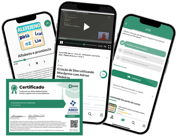
Exercises to train your knowledge

100% free, from content to certificate

Ready to get started?Download the app and get started today.

Install the app now

to access the course
Icon representing technology and business courses

Over 5,000 free courses

Programming, English, Digital Marketing and much more! Learn whatever you want, for free.

Calendar icon with target representing study planning

Study plan with AI

Our app's Artificial Intelligence can create a study schedule for the course you choose.

Professional icon representing career and business

From zero to professional success

Improve your resume with our free Certificate and then use our Artificial Intelligence to find your dream job.

You can also use the QR Code or the links below.

QR Code - Download Cursa - Online Courses

More free courses at Geography

Free Ebook + Audiobooks! Learn by listening or reading!

Download the App now to have access to + 5000 free courses, exercises, certificates and lots of content without paying anything!

  • 100% free online courses from start to finish

    Thousands of online courses in video, ebooks and audiobooks.

  • More than 60 thousand free exercises

    To test your knowledge during online courses

  • Valid free Digital Certificate with QR Code

    Generated directly from your cell phone's photo gallery and sent to your email

Cursa app on the ebook screen, the video course screen and the course exercises screen, plus the course completion certificate