Free Course Image Geography Through Maps

Free online courseGeography Through Maps

Duration of the online course: 20 hours and 32 minutes

New

Build map-reading skills fast in this free geography course—climate, tectonics, landforms and more, with practice questions to reinforce learning.

In this free course, learn about

  • Using maps to locate key latitudes: Equator, Tropics, Polar Circles, and interpret their significance
  • How solar angle causes higher sunlight intensity at the equator and lower at the poles
  • Solstices/equinoxes basics, incl. term for the longest day in the Northern Hemisphere
  • Equatorial climate features: high humidity, convection, heavy rainfall, and evergreen forests
  • Why subtropical deserts form (descending air, inhibited clouds) and why many lie on west coasts
  • Coriolis force role in deflecting winds/currents and shaping global circulation and weather
  • High-latitude biomes: taiga/tundra patterns such as 'tiger' vegetation and permafrost influence
  • Major world grasslands and their grain belts (e.g., European steppe/Black Sea wheat region)
  • Climate change patterns: strongest positive temperature anomalies in polar/high-latitude regions
  • Big Bang theory overview: universe beginning from an extremely dense, dimensionless singularity
  • Orogenies and mountain systems: Caledonian ranges; oldest fold mountains in India (Aravallis)
  • Key physiographic terms: 'rooftop of the world' (Tibetan Plateau) and major plateau systems
  • Rock types & lithosphere basics: intrusive igneous rocks; lithosphere composition and behavior
  • Plate tectonics and boundaries: divergent at Iceland; transform faults; volcanism and calderas

Course Description

Maps turn complex geography into clear, memorable patterns. This free online course helps you learn to read the world through maps and connect what you see on an atlas to real physical processes on Earth. Instead of treating geography as isolated facts, you will build a visual way of thinking that links latitude and sunlight, climate zones, deserts, winds, ocean influence, and global circulation to the places where these forces shape daily life.

You will strengthen core skills such as interpreting location and scale, understanding why seasons vary across latitudes, and recognizing how climate characteristics emerge in different regions. Along the way, you will explore why some areas experience intense rainfall while others develop arid conditions, and how factors like cloud formation, humidity, vertical convection, and the Coriolis effect help organize global weather and climate patterns. This perspective makes it easier to remember what happens where and, more importantly, why it happens.

The course also supports a solid foundation in physical geography and Earth systems. You will connect maps with tectonic activity, plate boundaries, and the major structures that define the planet’s surface. Concepts such as shields and mineral-rich regions, fold mountains and ancient orogenies, rock formation, and key physiographic regions become easier to grasp when you can place them spatially. You will also encounter examples from across the world, from polar regions affected by climate anomalies to volcanic landscapes and distinctive vegetation belts, helping you practice geographic reasoning on real settings.

To keep learning active, the course includes exercises that check understanding and improve recall, making it suitable for students of school geography as well as learners preparing for competitive exams who need sharp, map-based clarity. By the end, you will be more confident in interpreting maps, explaining regional patterns, and using geographic concepts to make sense of news, climate discussions, and the physical layout of our planet.

Course content

  • Video class: Geography Through Maps l Pritesh Maturkar l UPSC 2024 l StudyIQ IAS English 58m
  • Exercise: What is the main difference in sunlight intensity between the equator and the poles on Earth?
  • Video class: Geography Through Maps l Lecture 02 l Pritesh Maturkar l UPSC 2024 l StudyIQ IAS English 56m
  • Exercise: What is the term for the longest day in the Northern Hemisphere?
  • Video class: Geography Through Maps l Lecture 03 l Pritesh Maturkar l UPSC 2024 l StudyIQ IAS English 56m
  • Exercise: Which of the following statements about the Tropic of Cancer and Tropic of Capricorn is true?
  • Video class: Geography Through Maps l Lecture 04 l Pritesh Maturkar l UPSC 2024 l StudyIQ IAS English 54m
  • Exercise: Which of the following statements about the equatorial region's climate is correct?
  • Video class: Geography Through Maps l Lecture 05 l Pritesh Maturkar l UPSC 2024 l StudyIQ IAS English 57m
  • Exercise: Which of the following regions is characterized by the world's hottest climates due to inhibited cloud formation?
  • Video class: Geography Through Maps l Lecture 06 l Pritesh Maturkar l UPSC 2024 l StudyIQ IAS English 58m
  • Exercise: Which of the following statements is true about the Tropic of Cancer?
  • Video class: Geography Through Maps l Lecture 07 l Pritesh Maturkar l UPSC 2024 l StudyIQ IAS English 1h03m
  • Exercise: Which of the following is the primary reason for the presence of tropical deserts, such as the Sahara, on the western sides of continents?
  • Video class: Geography Through Maps l Lecture 08 l Pritesh Maturkar l UPSC 2024 l StudyIQ IAS English 1h00m
  • Exercise: Which of the following best describes the function of Coriolis force in the Earth's weather systems?
  • Video class: Geography Through Maps l Lecture 09 l Pritesh Maturkar l UPSC 2024 l StudyIQ IAS English 54m
  • Exercise: What phenomenon is responsible for the formation of the distinct 'Tiger Vegetation' at latitudes 58 to 68 degrees north?
  • Video class: Geography Through Maps l Lecture 10 l Pritesh Maturkar l UPSC 2024 l StudyIQ IAS English 59m
  • Exercise: Which geographic region is known for having a unique grassland ecosystem that significantly contributes to Europe's grain production, particularly wheat?
  • Video class: Geography Through Maps l Lecture 11 l Pritesh Maturkar l UPSC 2024 l StudyIQ IAS English 55m
  • Exercise: In which region are positive temperature anomalies most evident due to global climate change?
  • Video class: Geography Through Maps l Lecture 12 l Pritesh Maturkar l UPSC 2024 l StudyIQ IAS English 54m
  • Exercise: Which of the following regions is most likely to have high rainfall due to high relative humidity and intense vertical convection?
  • Video class: Geography Through Maps l Lecture 13 l Pritesh Maturkar l UPSC 2024 l StudyIQ IAS English 56m
  • Exercise: What is the most widely accepted theory about the formation of the universe, which suggests it began from a singular dimensionless entity?
  • Video class: Geography Through Maps l Lecture 14 l Pritesh Maturkar l UPSC 2024 l StudyIQ IAS English 57m
  • Exercise: Which of the following mountain ranges is considered part of the Caledonian orogeny?
  • Video class: Geography Through Maps l Lecture 15 l Pritesh Maturkar l UPSC 2024 l StudyIQ IAS English 54m
  • Exercise: What is the oldest fold mountain range in India?
  • Video class: Geography Through Maps l Lecture 16 l Pritesh Maturkar l UPSC 2024 l StudyIQ IAS English 52m
  • Exercise: Which of the following geological features is known as the 'rooftop of the world'?
  • Video class: Geography Through Maps l Lecture 17 l Pritesh Maturkar l UPSC 2024 l StudyIQ IAS English 47m
  • Exercise: What type of rock is primarily formed through the cooling and solidification of magma beneath the Earth's surface?
  • Video class: Geography Through Maps l Lecture 18 l Pritesh Maturkar l UPSC 2024 l StudyIQ IAS English 53m
  • Exercise: Which of the following regions is considered one of the most important shield regions rich in minerals in Africa?
  • Video class: Geography Through Maps l Lecture 19 l Pritesh Maturkar l UPSC 2024 l StudyIQ IAS English 48m
  • Exercise: Which of the following statements about the Earth's lithosphere is correct?
  • Video class: Geography Through Maps l Lecture 20 l Pritesh Maturkar l UPSC 2024 l StudyIQ IAS English 51m
  • Exercise: What is the main geographical process observed at the boundary between the North American Plate and the Eurasian Plate in Iceland?
  • Video class: Geography Through Maps l Lecture 21 l Pritesh Maturkar l UPSC 2024 l StudyIQ IAS English 52m
  • Exercise: In the context of Earth's physiography, which of the following interactions between lithospheric plates is characterized by plates just slipping past one another without creating or destroying crust?
  • Video class: Geography Through Maps l Lecture 22 l Pritesh Maturkar l UPSC 2024 l StudyIQ IAS English 1h08m
  • Exercise: Which island is known for having volcanic peaks and calderas in New Zealand?

This free course includes:

20 hours and 32 minutes of online video course

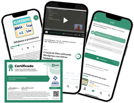
Digital certificate of course completion (Free)

Exercises to train your knowledge

100% free, from content to certificate

Ready to get started?Download the app and get started today.

Install the app now

to access the course
Icon representing technology and business courses

Over 5,000 free courses

Programming, English, Digital Marketing and much more! Learn whatever you want, for free.

Calendar icon with target representing study planning

Study plan with AI

Our app's Artificial Intelligence can create a study schedule for the course you choose.

Professional icon representing career and business

From zero to professional success

Improve your resume with our free Certificate and then use our Artificial Intelligence to find your dream job.

You can also use the QR Code or the links below.

QR Code - Download Cursa - Online Courses

More free courses at Geography

Free Ebook + Audiobooks! Learn by listening or reading!

Download the App now to have access to + 5000 free courses, exercises, certificates and lots of content without paying anything!

  • 100% free online courses from start to finish

    Thousands of online courses in video, ebooks and audiobooks.

  • More than 60 thousand free exercises

    To test your knowledge during online courses

  • Valid free Digital Certificate with QR Code

    Generated directly from your cell phone's photo gallery and sent to your email

Cursa app on the ebook screen, the video course screen and the course exercises screen, plus the course completion certificate