

Introduction to Seismology Tools and Techniques
Seismology, a fascinating branch of geoscience within physical geography, focuses on studying seismic waves and the processes that generate them. This field relies on various tools and methods to detect, record, and analyze Earth’s vibrations, especially those from earthquakes. But how do seismologists capture and interpret these subtle or massive tremors? Let’s explore the essential instruments and techniques they use.
Key Instruments in Seismology
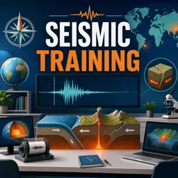
- Seismometers: Sensitive devices that detect ground movements and convert them into electrical signals. Modern seismometers can sense vibrations too faint for human perception.
- Seismographs: These record seismic activity by producing seismograms—wavy lines that visually represent seismic wave arrival and intensity.
- Accelerometers: Used mainly to record strong shaking during large earthquakes, helping researchers design safer buildings in quake-prone areas.
Seismic Networks: Collecting Global Data
To monitor seismic activity worldwide, seismologists utilize seismic networks—interconnected stations that gather and share data across local, regional, and global scales. These networks provide alerts and contribute to a comprehensive understanding of Earth’s seismic behavior.
Analyzing Seismic Signals
Once ground movements are recorded, seismologists analyze seismograms by identifying different seismic waves—P-waves, S-waves, and surface waves. Through this analysis, they can:
- Locate the earthquake’s epicenter and depth.
- Determine the magnitude and intensity of seismic events.
- Map fault lines and assess earthquake hazards.
Modern Advances: Digital Seismology and Remote Sensing
Technological progress has enabled digital seismology, allowing real-time data processing and sharing. Combined with computer simulations and remote sensing, these advances reveal underground structures and support disaster response strategies.
Conclusion
Seismology’s advanced tools and techniques deepen our understanding of Earth’s structure and seismic activity. As technology evolves, seismologists become increasingly equipped to protect communities and expand our knowledge of the planet’s dynamic nature.