

The ground beneath your feet feels solid and still, but on a very long timescale it is slowly moving. Earth’s outer shell is broken into huge pieces called tectonic plates, and their movement explains mountain ranges, ocean trenches, earthquakes and volcanoes. This article introduces the theory of plate tectonics in simple terms and shows why geological activity concentrates in certain places on the map.
What are tectonic plates?
Earth has several layers. At the center is the core, surrounded by the mantle, a thick layer of hot rock that flows very slowly over long periods. On top sits the crust, a thin, rigid outer layer. The crust together with the uppermost part of the mantle forms the lithosphere, and it is broken into large slabs called tectonic plates.
These plates float on a softer, hotter zone of the mantle called the asthenosphere. Scientists recognize about a dozen major plates, such as the Pacific, North American, Eurasian, African, South American, Antarctic and Indo-Australian plates, plus several smaller ones. They move at a pace of a few centimeters per year, roughly comparable to the speed at which fingernails grow.
From continental drift to plate tectonics
In the early twentieth century, Alfred Wegener proposed continental drift: the idea that the continents were once joined in a single landmass and drifted apart. He pointed to the way the coastlines of South America and Africa seem to fit together, and to matching fossils and rock types on separate continents. His idea was controversial at first because he could not explain what force moved the continents.
Later discoveries, especially the mapping of the ocean floor and the finding of mid-ocean ridges where new crust forms, led to the modern theory of plate tectonics. This theory is now the foundation of Earth science.
What makes the plates move?
Several processes are thought to contribute. Heat from Earth’s interior drives slow convection in the mantle. At the same time, at some boundaries the cold, dense edge of a plate sinks into the mantle and pulls the rest of the plate along, a process called slab pull. New crust forming at ridges can also push neighboring plates apart. Scientists continue to study how these forces combine, but the general picture of a restless, slowly moving surface is well established.
The three types of plate boundaries
Most geological action happens where plates meet. There are three main kinds of boundaries:
| Boundary type | Plate movement | Typical features |
|---|---|---|
| Divergent | Plates move apart | Mid-ocean ridges, rift valleys, new crust |
| Convergent | Plates move toward each other | Mountain ranges, deep ocean trenches, volcanoes, strong earthquakes |
| Transform | Plates slide past each other | Faults and frequent earthquakes |
Divergent boundaries: where new crust is born
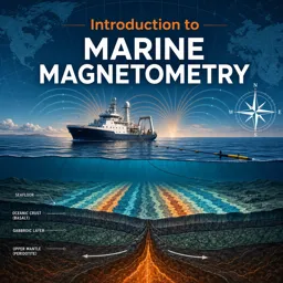
When plates pull apart, magma rises from below and cools to form new crust. In the middle of the Atlantic Ocean, the Mid-Atlantic Ridge is a long underwater mountain chain created this way, and the ocean slowly widens. On land, similar processes create rift valleys, such as the East African Rift, where the continent is gradually stretching.
Convergent boundaries: collisions and subduction
When plates collide, the outcome depends on what is colliding:
- Oceanic plate meets continental plate: the denser oceanic plate sinks beneath the continental one in a process called subduction. This forms deep ocean trenches and volcanic mountain ranges, such as the Andes.
- Oceanic meets oceanic: one plate subducts under the other, often producing chains of volcanic islands called island arcs.
- Continental meets continental: neither plate sinks easily, so the crust crumples and uplifts into massive mountain ranges. The Himalayas formed this way, where the Indian plate pushes into the Eurasian plate.
Transform boundaries: sliding and shaking
At transform boundaries, plates grind past each other horizontally. The San Andreas Fault in California is a well-known example. The plates do not slide smoothly; they get stuck, stress builds up, and eventually the rocks slip suddenly, releasing energy as an earthquake.
Why earthquakes happen along plate edges
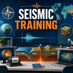
An earthquake is the shaking caused by a sudden release of energy in the crust, usually along a fault. Because plate boundaries are where most stress accumulates, most earthquakes are concentrated along them. The point underground where the rupture starts is called the focus, and the point on the surface directly above it is the epicenter. Seismic waves travel outward from the focus, and instruments called seismographs record them.
Volcanoes and the Ring of Fire
Volcanoes form where magma reaches the surface. This often happens at subduction zones, where sinking plates release water that helps melt the rock above, and at divergent boundaries, where the crust is thin. A few volcanoes, such as those in Hawaii, form over hotspots, plumes of hot material rising from deep in the mantle, away from plate edges.
The Ring of Fire is a horseshoe-shaped region around the Pacific Ocean where many subduction zones and transform boundaries are found. It hosts a large share of the world’s active volcanoes and earthquakes, which is why countries along the Pacific coast pay close attention to seismic monitoring and preparedness.
Quick study tips
- Link each boundary type to a movement: apart, together, sideways.
- Associate each with a landform: ridges, mountains and trenches, faults.
- Use a world map to locate the major plates and the Ring of Fire.
- Remember that plate movement is slow, but its cumulative effects are enormous.
Conclusion
Plate tectonics ties together mountains, oceans, earthquakes and volcanoes in a single elegant explanation. Understanding it helps you read maps, interpret news about natural events and appreciate how dynamic our planet is. If you enjoy geography and Earth science, the related courses on Cursa can help you continue exploring these topics with structured lessons and practice material.