
Exercises
Explore how location influences elections and political representation. This quiz examines electoral districts, redistricting, gerrymandering, voting systems, demographic patterns, map interpretation, and spatial statistics. Questions range from foundational definitions to the analysis of district maps and vote-seat relationships.
Answer the questions below and check the explanation for each answer.
0/16 answered
Auto audio on: the next questions will be read aloud when you click Continue.
Electoral geography studies how voting, representation, district boundaries, and political behavior vary across space.
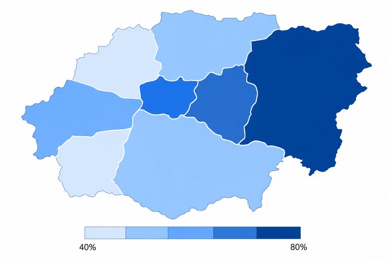
A turnout percentage standardizes the data by the number of eligible voters, making districts of different sizes comparable.
Malapportionment occurs when districts have unequal populations but receive the same representation, causing votes to carry unequal weight.
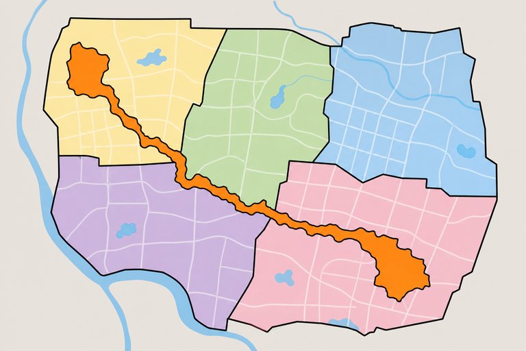
A district with a highly elongated, twisting, or irregular boundary has low geographic compactness. Its density and competitiveness cannot be determined from shape alone.
Cracking disperses a group's voters across multiple districts, reducing their ability to influence the result in any single district.
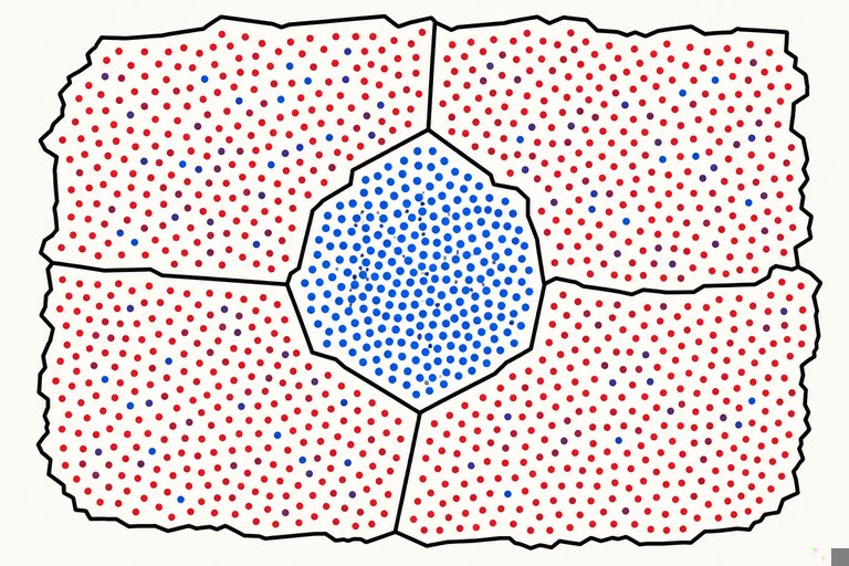
Packing concentrates many opposing voters in a small number of districts, limiting their influence elsewhere.
A majority-minority district can provide a geographically concentrated minority community with an effective opportunity to elect candidates it prefers. It does not guarantee a candidate's identity.
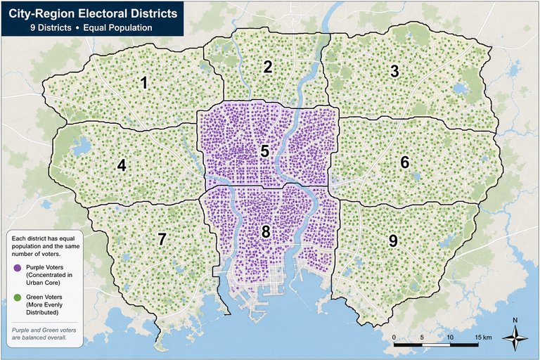
In district-based elections, concentrated support may produce enormous victories in a few places while yielding fewer seats than more efficiently distributed support.
The efficiency gap compares wasted votes: ballots cast for losing candidates and ballots cast for winners beyond the number needed to win.
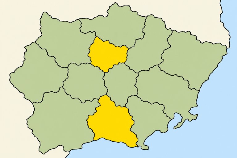
Contiguity generally requires every part of a district to be physically connected to the rest of that district.
A community of interest is a population connected by shared social, cultural, economic, or policy concerns that may benefit from unified representation.
Official census counts provide the population data used to reapportion seats and redraw districts toward population equality.
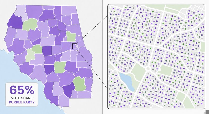
The ecological fallacy occurs when conclusions about individuals or subgroups are inferred improperly from aggregate geographic data.
A swing district has no consistently dominant party and can change party control as voter preferences or turnout shift.
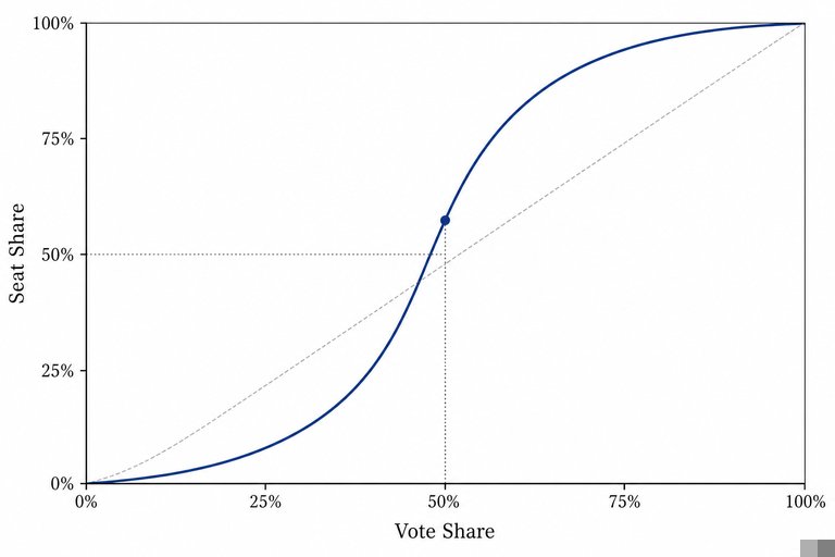
Under partisan symmetry, equal vote shares should offer comparable seat outcomes. A large displacement from 50% of seats at 50% of votes suggests bias.
Positive spatial autocorrelation means geographically close observations tend to resemble one another, producing clusters of similar election results.

Free CourseHuman Geography course
5

(5)

3h34m

34 exercises

Free CourseGeography Through Maps
5
(1)
20h32m
22 exercises

Free CoursePhysical Geography
5
(2)
11h24m
42 exercises

Free CourseGeography
4.8
(31)
6h49m
11 exercises

Free CourseWorld geography
4.7

(28)
2h03m
10 exercises

Free CourseWorld Regional Geography
4.7
(3)
3h42m
10 exercises

Free CourseGeography
4.6
(21)
28h42m
11 exercises

Free CourseUK geography
New
8h58m
17 exercises
Thousands of online courses in video, ebooks and audiobooks.
To test your knowledge during online courses
Generated directly from your cell phone's photo gallery and sent to your email

Download our app via QR Code or the links below:.



Carry knowledge in your pocket.
Download the Cursa app.
There are hundreds of free courses available, with a free certificate of completion that is saved in your mobile image gallery.
Download the app to access the Course Completion Certificate for Free.


+ 10 million
students

Free and Valid
Certificate

60 thousand free
exercises

4.8/5 rating in
app stores

Free courses in
video and ebooks