
Exercises
This quiz assesses practical knowledge needed for introductory land surveying fieldwork. Topics include total station operation, benchmarks, differential leveling, contour interpretation, traverse closure, GNSS accuracy, control points, resection, construction stakeout, field documentation, instrument testing, and roadside safety. The questions combine basic concepts with calculations and realistic field situations.
Answer the questions below and check the explanation for each answer.
0/20 answered
Auto audio on: the next questions will be read aloud when you click Continue.
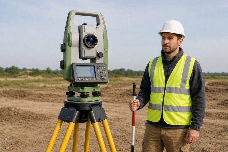
A total station combines electronic angle measurement with electronic distance measurement and onboard coordinate calculations.
A benchmark is a durable reference point whose elevation is known. Surveyors use it to establish or verify elevations elsewhere.
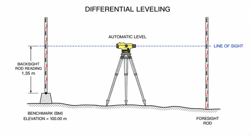
Height of instrument equals known elevation plus backsight: 100.00 + 1.35 = 101.35 m.
Point elevation equals height of instrument minus foresight: 101.35 - 0.85 = 100.50 m.

Centering the circular bubble makes the prism pole vertical. A tilted pole can place the prism horizontally away from the surveyed point.
Closing on a known benchmark allows the computed final elevation to be compared with its published value, revealing leveling misclosure.
A traverse consists of connected survey lines whose lengths and directions are measured to determine point positions and establish control.
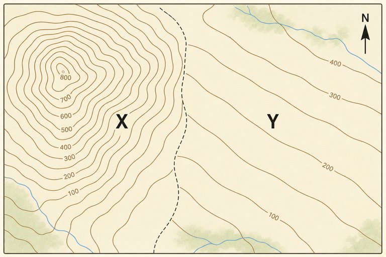
Closely spaced contours represent a rapid change in elevation over a short horizontal distance, which indicates a steep slope.
At 1:500, 2 cm represents 1,000 cm on the ground. Since 1,000 cm equals 10 m, the ground distance is 10 m.
A single strike-through preserves the original entry while clearly documenting the correction. This supports traceability and professional recordkeeping.
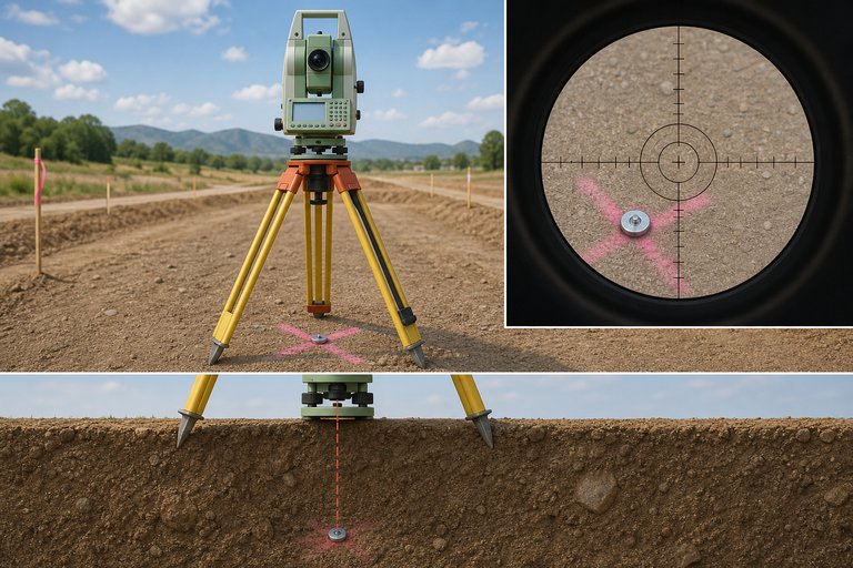
The optical plummet is used to position the instrument's vertical axis over a ground mark. An offset mark indicates improper centering.
Resection calculates an occupied station's coordinates and orientation by observing two or more points with known coordinates.
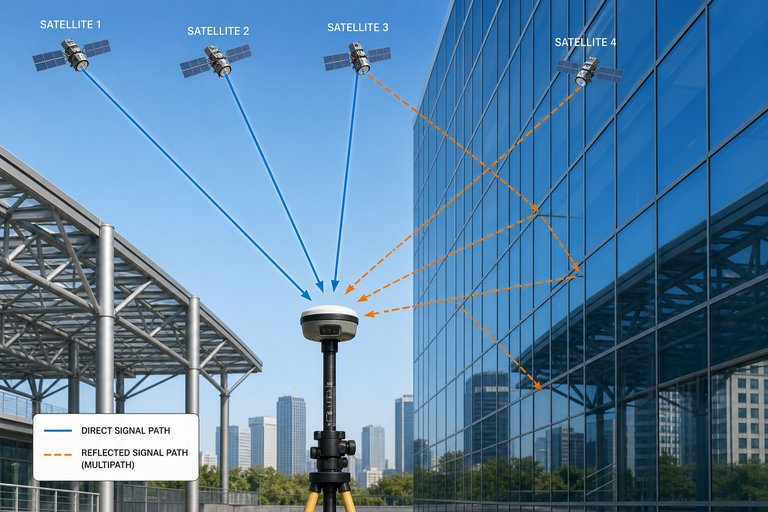
Multipath occurs when GNSS signals reflect from buildings or other surfaces before reaching the receiver, distorting the measured travel time.
A lower PDOP generally indicates stronger satellite geometry and less amplification of measurement error. A value of 1.5 is preferable to 8.0 or 12.0.
A control point should be stable, identifiable, recoverable, and supported by reliable coordinate or elevation records.
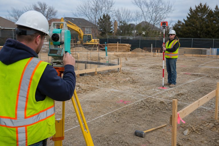
Stakeout translates design coordinates, alignments, offsets, or elevations into marked positions that construction crews can use in the field.
Coordinate misclosure is the residual positional difference after a traverse is computed to a known closing point. It is used to assess survey quality.
A two-peg test checks whether the level's line of sight is truly horizontal when the instrument is leveled and reveals collimation error.
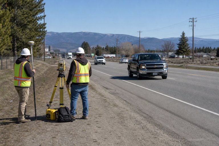
An approved traffic-control plan, warning devices, safe work positioning, and high-visibility clothing help protect both the survey crew and road users.
Reciprocal observations from opposite sides help cancel systematic effects such as collimation error, Earth curvature, and atmospheric refraction across long sights.
Thousands of online courses in video, ebooks and audiobooks.
To test your knowledge during online courses
Generated directly from your cell phone's photo gallery and sent to your email

Download our app via QR Code or the links below:.



Carry knowledge in your pocket.
Download the Cursa app.
There are hundreds of free courses available, with a free certificate of completion that is saved in your mobile image gallery.
Download the app to access the Course Completion Certificate for Free.


+ 10 million
students

Free and Valid
Certificate

60 thousand free
exercises

4.8/5 rating in
app stores

Free courses in
video and ebooks